The Secret Language of Clouds: What Is the Sky Trying to Tell You?
Ever wondered what those strange shapes in the sky actually mean? From towering thunderstorms to UFO-shaped clouds, learn how to read the sky and discover what different clouds can tell you about the weather.

Long before we had weather apps, satellites and computer models capable of predicting what the atmosphere might do next, people had to rely on something much simpler when they wanted to know what the weather had in store: they looked up.
Clouds have always been one of nature's best clues about what's happening in the atmosphere. While you can't necessarily predict tomorrow's weather by looking at a single cloud, the type, shape and movement of clouds can tell you quite a lot about the conditions above your head and, in some cases, what might be coming next.
Some clouds are harmless and simply drift lazily across a blue sky. Others can be a warning that the atmosphere is becoming unstable and that thunderstorms could be developing. There are also clouds that look so strange that they appear to have been designed by Hollywood rather than nature.
The good news is that you don't need to be a meteorologist to start understanding them. Once you know what to look for, the sky becomes a little like a weather map that is constantly changing above you.
So, let's take a look at some of the most interesting clouds you're likely to see and discover what they're actually trying to tell you.
Cumulus: The Classic Fluffy Cloud
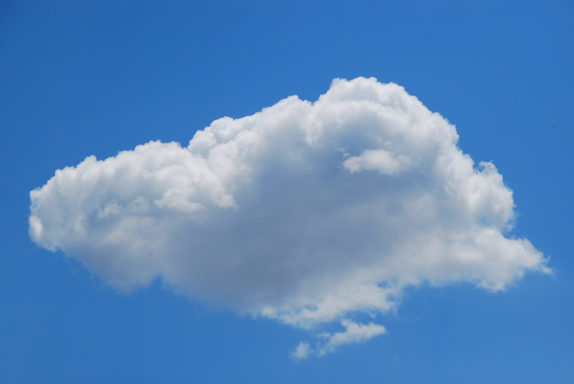
Cumulus clouds are probably the first clouds that come to mind when you think about the sky. They're the familiar white, fluffy clouds that often look like giant cotton balls floating above the landscape, and on a pleasant day they can make the sky look almost cartoonishly perfect.
These clouds form when warm air rises from the Earth's surface. As that air rises, it cools, and the moisture within it condenses into tiny water droplets that form the cloud. Small cumulus clouds are generally associated with fair weather and relatively stable conditions, which is why they're often a welcome sight on a sunny day.
However, it's worth keeping an eye on them. Cumulus clouds can grow vertically when the atmosphere becomes increasingly unstable. A cloud that starts the morning as a harmless-looking puff of white can gradually become much taller and darker as warm, moist air continues to rise.
When that happens, you may be watching the early stages of a much more powerful cloud developing.
Which brings us to one of the atmosphere's biggest attention seekers.
Cumulonimbus: The Sky's Angry Giant
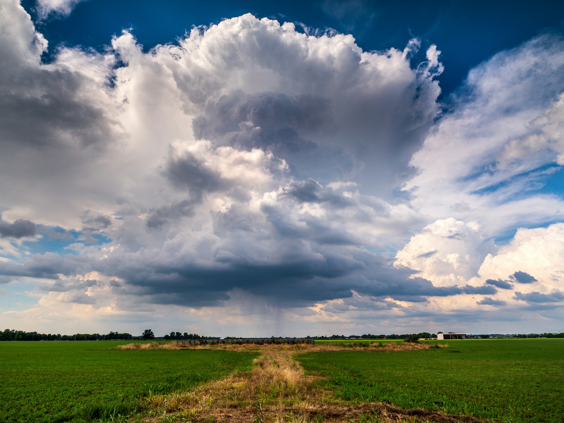
f clouds had personalities, cumulonimbus would probably be the one that walks into a room and immediately starts causing problems.
These enormous clouds can grow to impressive heights and are associated with thunderstorms, heavy rainfall, lightning, hail and strong, sometimes damaging winds. They can also produce tornadoes under the right conditions.
One of their most recognisable features is the anvil-shaped top. As the cloud grows upwards, it eventually reaches a layer of the atmosphere where the rising air can no longer continue climbing as easily. The cloud then spreads out horizontally, creating the distinctive shape that can be seen from a considerable distance.
If you see a cumulonimbus cloud developing nearby, it doesn't automatically mean you're about to experience severe weather. However, it is a good indication that the atmosphere is active and that conditions could change quickly.
If you hear thunder, you're already close enough to a storm to take lightning seriously. And if that enormous dark cloud is heading directly towards you, it might be a good time to bring the washing inside.
Your freshly washed car can probably wait.
Stratus: When the Sky Turns Into a Blanket
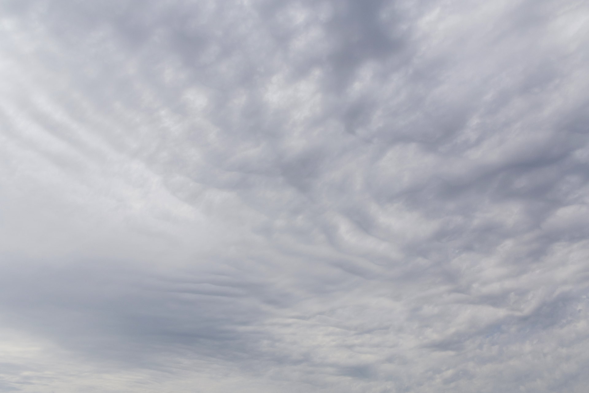
Stratus clouds are almost the complete opposite of cumulonimbus. Instead of towering dramatically into the sky, they spread out horizontally, creating a widespread layer of grey cloud that can make an entire day feel dull and gloomy.
These clouds often form when a large area of air rises slowly and evenly, and they can bring light rain or drizzle. They are usually associated with relatively stable atmospheric conditions rather than violent weather, although persistent low cloud can still have a significant impact on visibility and travel.
If you've ever woken up to a day where the entire sky seems to have turned into one giant grey ceiling, there's a good chance you're looking at stratus cloud.
It's not exactly the most exciting weather, but at least it's generally not trying to throw a golf ball sized piece of ice at your roof.
Altocumulus: The Sky Might Be Up To Something

Altocumulus clouds are found higher in the atmosphere and often appear as groups or patches of small, rounded clouds. Depending on how they form, they can create patterns that resemble rows of cotton balls or fish scales stretching across the sky.
On their own, altocumulus clouds aren't necessarily a sign that bad weather is about to arrive. However, their appearance can sometimes provide clues about atmospheric conditions, particularly when they develop on a warm and humid day.
If these clouds begin to grow vertically, they may indicate that the atmosphere is becoming increasingly unstable. In some situations, that instability can contribute to the development of thunderstorms later in the day.
So while altocumulus clouds aren't exactly the sky shouting, "RUN!", they can sometimes be nature's way of quietly clearing its throat before the weather gets interesting.
Lenticular Clouds: The UFOs of the Sky

Lenticular clouds are among the strangest-looking clouds you're likely to see. Their smooth, lens-shaped appearance can make them look almost completely artificial, which is probably why photographs of them are regularly mistaken for UFO sightings.
They typically form near mountains when moist air flows over and around the terrain. Under the right atmospheric conditions, the air can create standing waves, allowing clouds to form in a distinctive lens-like shape.
Although they may look peaceful, lenticular clouds can be associated with strong winds and turbulence, particularly around mountainous areas. Pilots are well aware of the conditions that create them because the same atmospheric waves responsible for the clouds can create challenging flying conditions.
So, if you spot one hovering mysteriously above a mountain, it probably isn't an alien spacecraft.
Probably.
Mammatus: The Clouds That Look Completely Backwards
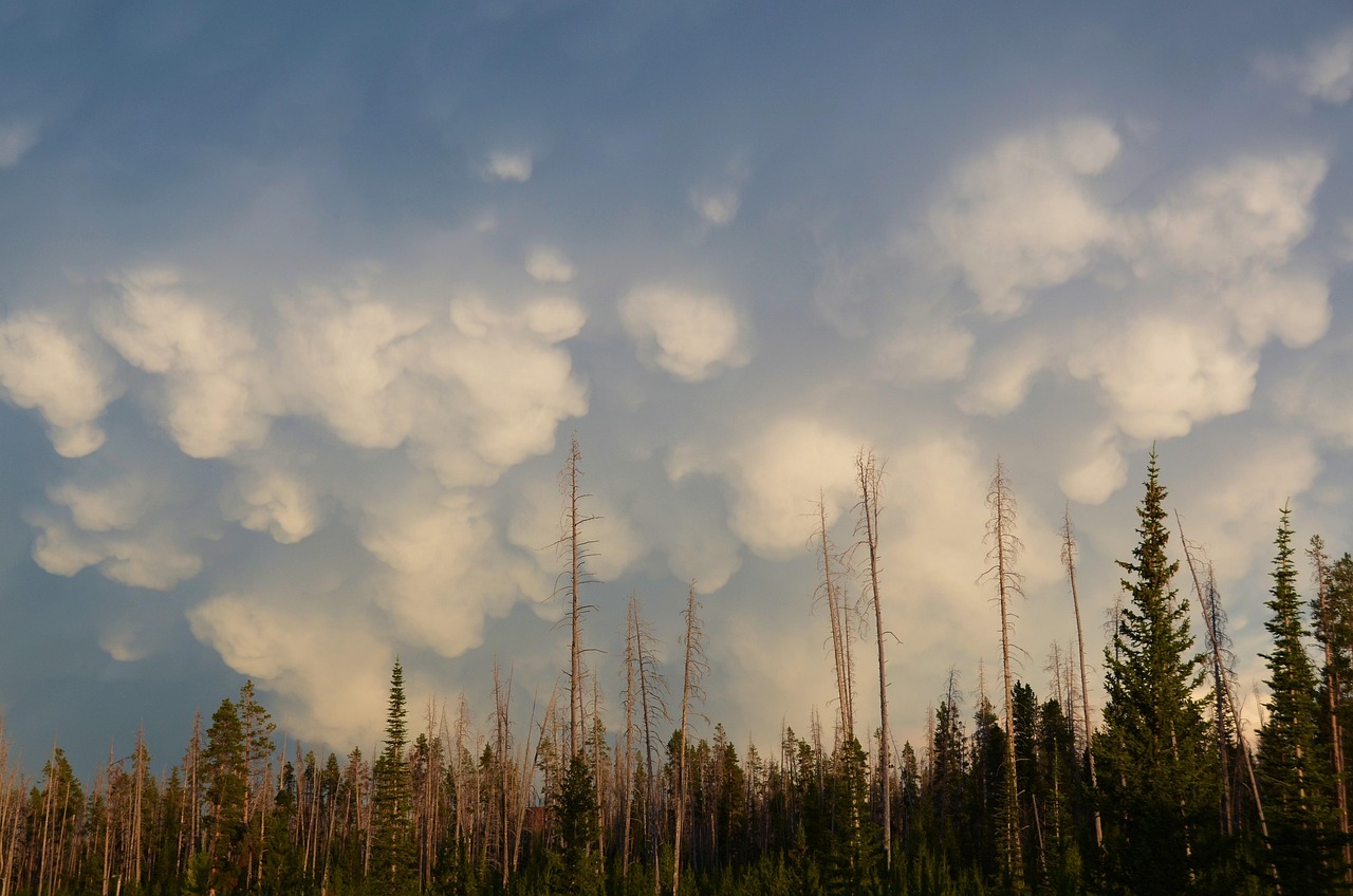
Mammatus clouds are among the most bizarre formations in the sky. They appear as a series of rounded, pouch-like structures hanging underneath a larger cloud, creating the impression that the sky has somehow turned upside down.
Their unusual appearance is caused by complex processes involving sinking air and differences in temperature and moisture within the atmosphere. Mammatus formations are often seen in association with powerful thunderstorms, although the clouds themselves aren't responsible for producing severe weather.
Seeing mammatus clouds can be a spectacular experience, especially when they're illuminated by the setting sun. Their presence can indicate that you're near a powerful storm system, but they don't necessarily mean that severe weather is directly overhead.
Still, if the sky suddenly looks like it has grown a collection of giant bubbles, it's probably worth checking what the rest of the weather is doing.
The atmosphere may be showing off, but there's a good chance there's a serious storm somewhere nearby.
Shelf Clouds: The Wall Coming Towards You
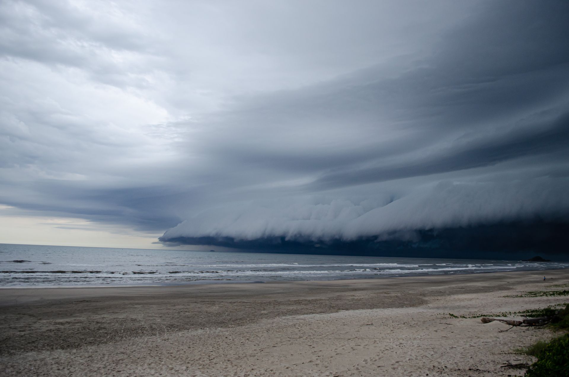
A shelf cloud is one of those formations that can make you stop what you're doing and stare.
These long, horizontal cloud structures often appear along the leading edge of thunderstorms and can look like a giant dark wall stretching across the horizon. As they approach, they can create a dramatic and sometimes intimidating sight.
Shelf clouds are associated with the outflow of thunderstorms and can bring strong, sudden winds as the storm approaches. They are not tornadoes, although the storms that produce them can still be dangerous.
If you see a shelf cloud moving towards you, the best thing to do is pay attention to the weather warnings in your area and prepare for the conditions that may arrive with the storm.
Wall Clouds: When Things Get Serious
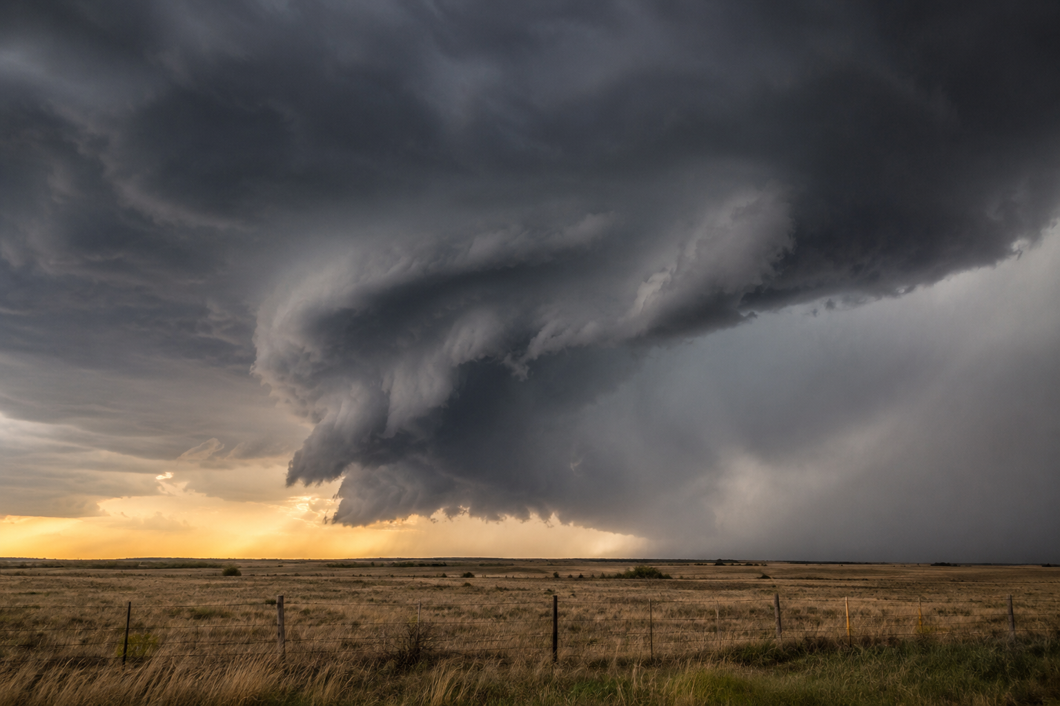
Wall clouds are another feature associated with powerful thunderstorms. They form as a lowered section of cloud beneath the main storm and can sometimes appear as a large, dark area hanging beneath the base of the thunderstorm.
What makes wall clouds particularly interesting is that some can rotate. When a rotating wall cloud develops within a powerful thunderstorm, it can sometimes be associated with tornado formation.
That doesn't mean every wall cloud will produce a tornado. Most won't. However, a rotating wall cloud is a feature that meteorologists and storm spotters take seriously because it can indicate that the storm has developed strong rotation.
If you ever see one during a severe thunderstorm, it's definitely not the time to stand outside with your phone trying to get the perfect TikTok.
Take shelter and keep an eye on official weather warnings instead.
Cirrus Clouds: The High-Level Warning

Cirrus clouds are thin, wispy clouds that form very high in the atmosphere, often appearing as delicate streaks or feathery strands against an otherwise blue sky. Because they're made mostly of ice crystals, they can take on a soft, almost brushstroke-like appearance.
On their own, cirrus clouds usually don't bring rain to the ground. However, they can sometimes be an early sign that a change in weather is approaching. When a large area of cirrus gradually spreads across the sky and becomes thicker, it can indicate that a weather system is moving in, with rain or snow potentially arriving later.
So, Can You Really Predict The Weather By Looking At Clouds?
To a certain extent, yes.
Clouds can provide useful clues about what's happening in the atmosphere. A rapidly growing cumulonimbus cloud is a clear indication that thunderstorms may be developing, while certain high-level clouds can appear ahead of an approaching weather system.
However, cloud watching isn't a replacement for a proper weather forecast. The atmosphere is incredibly complicated, and the same type of cloud can develop under different conditions. That's why meteorologists combine information from clouds with satellite imagery, radar, weather stations, atmospheric measurements and computer models.
Still, learning to recognise clouds gives you something that your weather app can't quite provide: a better understanding of what's happening directly above you.
The next time you look outside and notice a strange cloud formation, take a moment to study it. Is it growing upwards? Spreading across the sky? Moving quickly? Changing shape?
You might be watching a thunderstorm develop, seeing the first signs of a change in the weather, or simply witnessing one of the atmosphere's many spectacular displays.
Once you start learning the language of clouds, the sky becomes a little more interesting. Instead of seeing a random collection of white and grey shapes, you're looking at a constantly changing picture of what's happening in the atmosphere.
And sometimes, if you know what you're looking at, the sky really does have something to tell you.