Super El Niño Is Brewing — And The Ocean Is Already Telling Us Why
A potentially historic El Niño is building in the Pacific. What happens beneath the ocean could have major consequences for South Africa’s rainfall, crops, water supplies and food prices.
Something unusual is happening in the Pacific Ocean, and while it may seem like a problem for a part of the world thousands of kilometres away, South Africa has plenty of reason to pay attention.
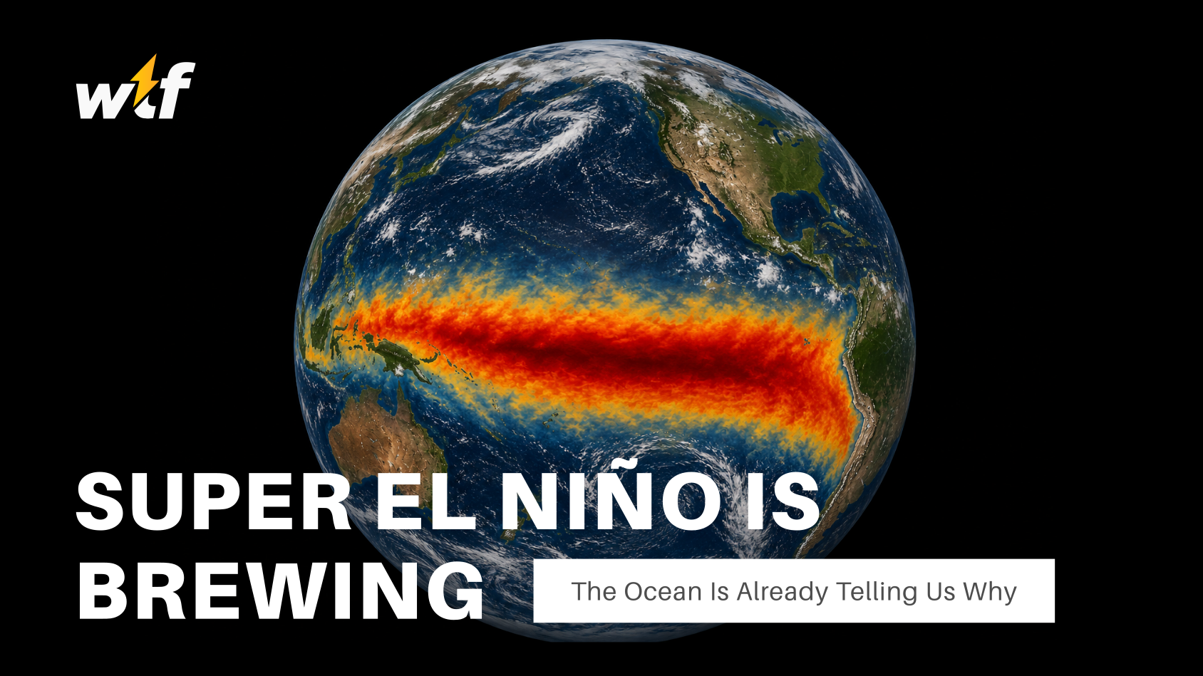
A strong El Niño has developed across the tropical Pacific, and the South African Weather Service (SAWS) is warning that the event could strengthen significantly as we move into spring. The National Oceanic and Atmospheric Administration (NOAA) in the United States is also forecasting a very strong event, with the latest outlook suggesting that this could become one of the most significant El Niño events in modern records.
That is a big statement when you consider the El Niños that have come before it.
How does this compare with the big three?
Three previous events are generally regarded as the benchmark for exceptionally strong El Niños: 1982–83, 1997–98 and 2015–16.
The 1982–83 event was so significant that it exposed major gaps in scientists’ ability to monitor what was happening across the Pacific Ocean. The event helped drive the development of the observing network that is now used to monitor El Niño in real time.
Then came 1997–98, one of the most powerful El Niños ever recorded. It produced major weather disruptions around the world, from devastating floods in some regions to severe drought in others.
The 2015–16 event was another extraordinary example. It coincided with exceptionally high global temperatures and became one of the strongest El Niños ever observed.
The developing 2026–27 event is now being compared with those three.
It is important to be careful here. We cannot officially declare a new record while the event is still developing, and there are several different ways of measuring El Niño strength. However, the signals coming from the Pacific are becoming increasingly difficult to ignore. Sea-surface temperatures are significantly above average across the central and eastern equatorial Pacific, while an enormous amount of additional heat is sitting below the surface.
That hidden heat is one of the most important parts of the story.
The Pacific is warming from below
When you look at a satellite image of the Pacific during an El Niño, the most obvious feature is the large area of unusually warm water near the surface. But scientists are also interested in what is happening hundreds of metres below it.
The Pacific Ocean can store vast amounts of heat beneath the surface, and during the development of a strong El Niño, that subsurface heat can become a major source of energy for the event.
Scientists monitor this using a network of instruments spread across the tropical Pacific. One of the most important is the Tropical Atmosphere Ocean (TAO) array, operated as part of an international observing system. The network consists of moored buoys positioned across the Pacific that continuously collect measurements including temperature, winds and other ocean and atmospheric conditions.
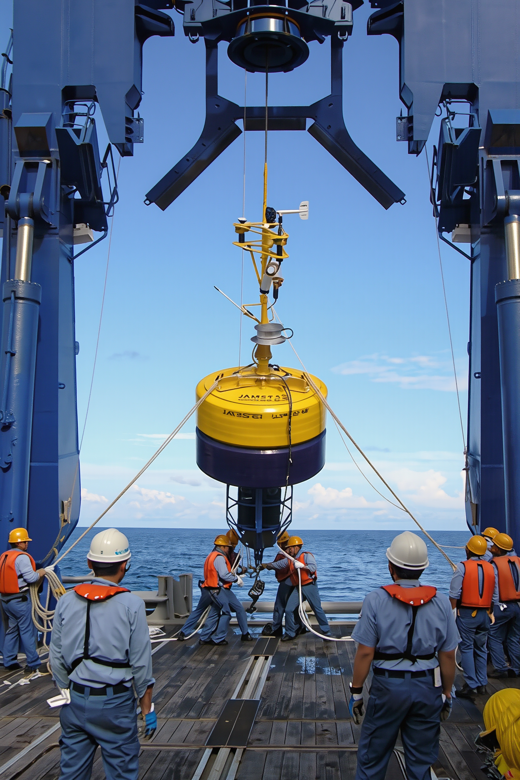
Some of these instruments measure temperatures at several depths, allowing scientists to see how heat is moving through the ocean rather than simply watching what happens at the surface.
That is particularly important because some of the biggest changes associated with El Niño can begin beneath the waves before they become obvious at the surface.
The strange waves travelling beneath the ocean
One of the key mechanisms scientists watch for is an oceanic Kelvin wave.
Despite the name, these aren't waves crashing onto beaches. They are enormous movements of water and energy that can travel along the equator, carrying warm water from one part of the Pacific towards another.
During the development of El Niño, bursts of westerly winds can push warm water downwards and eastwards. This creates what is known as a downwelling Kelvin wave, which can travel across the Pacific beneath the surface.
As these waves move east, they can alter the depth of the thermocline. This is the boundary between the warmer surface layer of the ocean and the much colder water below it.
Under normal conditions, strong trade winds help push warm surface water towards the western Pacific. At the same time, cold, nutrient-rich water from deeper in the ocean rises towards the surface in the eastern Pacific in a process known as upwelling.
El Niño disrupts that pattern.
When the trade winds weaken, the warm water that has accumulated in the western Pacific can begin shifting eastwards. The thermocline changes position, while the usual upwelling of cold water becomes weaker. With less cold water reaching the surface, the eastern and central Pacific can warm even further.
This creates a feedback loop that can help strengthen the El Niño.
The remarkable thing is that scientists can actually watch many of these changes happening in real time. The TAO observing network provides measurements from across the Pacific, helping researchers track both surface conditions and the hidden changes taking place beneath them.
It means meteorologists aren't simply looking at a map of warm and cold colours. They are effectively watching a three-dimensional ocean system evolve.
Why South Africa should care
So what does a warming Pacific Ocean have to do with South Africa?
Quite a lot.
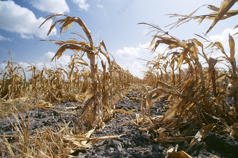
El Niño can influence the position and strength of large-scale atmospheric circulation patterns, changing where rain-producing systems develop and where they don't. Across southern Africa, strong El Niño events are commonly associated with an increased risk of hotter and drier conditions, particularly during the summer rainfall season.
That does not mean every part of South Africa will suddenly experience drought, or that every single month will be dry. Weather is much more complicated than that. But El Niño changes the probabilities, and a particularly strong event can make the risk of prolonged heat and below-normal rainfall more concerning.
For South Africa, the timing could be particularly important.
The warmer months are critical for agriculture across large parts of the country. Farmers need enough rainfall to establish crops and maintain them through the growing season, while high temperatures can increase evaporation and the amount of water crops require.
A combination of below-normal rainfall and extreme heat can therefore become far more damaging than either one on its own.
The consequences can extend beyond agriculture too. Drier conditions can place additional pressure on dams and water resources, while hot and dry weather can increase the risk of wildfires.
For farmers, however, there is another problem developing at almost exactly the wrong time.
The fertiliser problem
The war involving Iran has created a completely separate threat to global agriculture, and it has nothing to do with making El Niño stronger.
The issue is the Strait of Hormuz, one of the world's most important shipping routes.
A significant amount of fertiliser production and trade is connected to the Middle East, and the disruption to shipping through the strait has already affected the movement of fertiliser and other agricultural inputs. The World Trade Organization (WTO) has warned that the conflict has severely disrupted trade in urea and phosphate fertilisers, with countries in Africa and Asia particularly exposed to potential shortages and higher prices.
This matters because modern agriculture depends heavily on fertiliser, particularly nitrogen fertilisers such as urea.
If fertiliser becomes more expensive or harder to obtain, farmers have to make difficult decisions. They can absorb the additional cost, reduce the amount they use, or potentially cut back on production.
None of those options are particularly attractive when farmers are already dealing with the possibility of hotter and drier conditions.
This is where the El Niño story becomes much bigger than a weather story.
The two problems are completely separate. The war in Iran does not cause El Niño, and El Niño does not influence the war. But if a very strong El Niño reduces crop yields at the same time that fertiliser supplies are disrupted and prices are elevated, the two shocks could put additional pressure on food production.
That doesn't automatically mean food shortages are coming. Global agriculture is a huge and complicated system, and farmers, governments and markets can respond to changing conditions.
But it does mean there is less room for things to go wrong.
The ocean is sending the warning
The fascinating thing about El Niño is that the weather impacts we eventually experience are only the final stage of a much larger process.
The story begins deep in the Pacific, where enormous quantities of heat move through the ocean. Winds push water around, Kelvin waves carry pulses of warm water beneath the surface, the thermocline shifts and the supply of cold water reaching the surface changes.
The atmosphere then responds to those changes, and the effects can travel thousands of kilometres away.
By the time South Africa feels the consequences through heat, rainfall or drought, the process has already been unfolding across the Pacific for months.
That is why scientists are paying such close attention to the ocean now.
The previous Super El Niños of 1982–83, 1997–98 and 2015–16 showed just how far-reaching these events can be. The developing 2026–27 event is not yet guaranteed to surpass them, but the signals are strong enough that it deserves serious attention.
For South Africa, the biggest concern is not simply whether El Niño arrives. It is how strong it becomes, how long its influence lasts and whether its effects coincide with other pressures facing agriculture.
A strong El Niño could mean greater pressure from heat and reduced rainfall. A disrupted fertiliser market could increase the cost of growing crops. If both problems persist at the same time, farmers could find themselves facing a difficult growing season from both sides.
For now, the Pacific is still writing the next chapter.