Nepal Floods: What Caused the Deadly Trishuli River Disaster
A glacier collapse near Langtang Lirung triggered flash floods that tore through Nepal's Trishuli River valley on August 26, killing hundreds and leaving thousands missing across the Nepal-China border region.
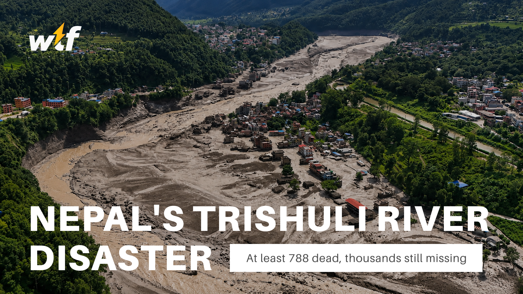
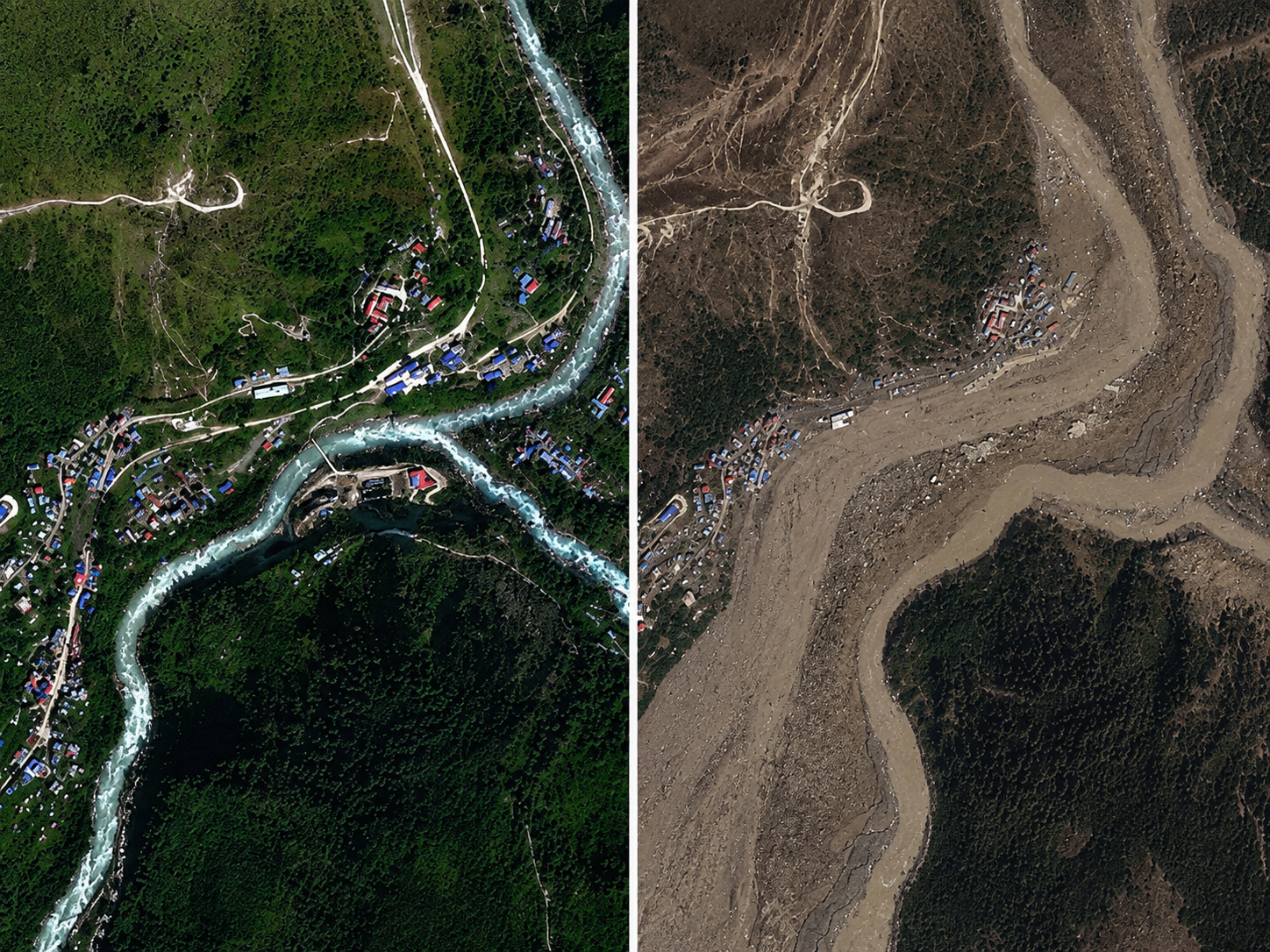
On the morning of August 26, 2026, a catastrophic chain of flash floods and mudslides ripped through a 72-kilometer stretch of Nepal's Trishuli River, devastating communities across the Rasuwa, Nuwakot, Dhading, Gorkha, Tanahun, Nawalparasi, and Chitwan districts. The disaster also destroyed the Gyirong Port complex on the China-Nepal border, a major hub for trade and tourism between the two countries, and swept some victims' remains as far as 240 kilometers away into India.
As of Monday, August 31, Nepali police say at least 788 people have died, with authorities struggling to manage the scale of loss. Officials have already buried nearly 200 unidentified bodies as morgue freezers ran out of capacity. Chinese authorities have confirmed an additional 16 deaths in the Tibet Autonomous Region. An estimated 3,000 people remain missing across both countries, and more than 900 workers at hydropower construction sites are still unaccounted for, with crews now racing to search flooded tunnels where many were believed to be working when the disaster struck. Rescue operations, which began as a search for survivors, have increasingly shifted toward recovery as the days pass.
The death toll has climbed steadily and sharply since the disaster began: Nepali police reported 389 fatalities on the first day, rising to 469 within 24 hours, then to 734 by August 29, and now to 788 as of this week's latest count. Officials caution the figure is likely to keep rising as search teams reach more remote, debris-choked areas.
What caused the flooding
Investigators believe the disaster began with a glacier collapse near Langtang Lirung in the Himalayas, which produced a tremor measuring 5.2 in magnitude, strong enough to be picked up by seismometers around the world. Video circulating on Chinese social media in the disaster's immediate aftermath showed a large section of glacier breaking away from a mountainside and plunging into the river below. The event is understood to have been triggered by a rapid slope failure involving a glacier in Langtang National Park, near the Nepal-China border.
The initial surge poured into the Lhende Khola, which feeds into the Bhote Koshi and then the Trishuli River, sending floodwaters racing south through Nepal. Water levels on the Trishuli reportedly rose as much as 9 meters (30 feet) in just 30 minutes. Scientists have described the speed of the resulting flood wave as extraordinary: researchers estimate the surge of water, pulverized ice, and rock traveled the first 22 kilometers at an average speed of roughly 193 kilometers per hour, covering nearly 14 miles in under seven minutes.
The debris flow ultimately traveled close to 100 kilometers, tearing through populated areas along the Lende Khola and Trishuli Khola rivers, including the Rasuwagadhi border crossing between China and Nepal. Notably, this was not the first major glacial disaster on this particular mountain: the same slope produced a massive debris avalanche in 2015, that time triggered by the magnitude-7.8 Gorkha earthquake, when several million cubic meters of ice broke loose.
In the days following the initial flood, Chinese authorities also warned of a "high risk" posed by a lake that had formed behind debris at the Nepal-China border, raising fears of a second, secondary flood. China briefly suspended rescue efforts at the border over that risk, and UN officials said they were using satellite technology to monitor the site for signs of renewed danger.
The human and infrastructure toll
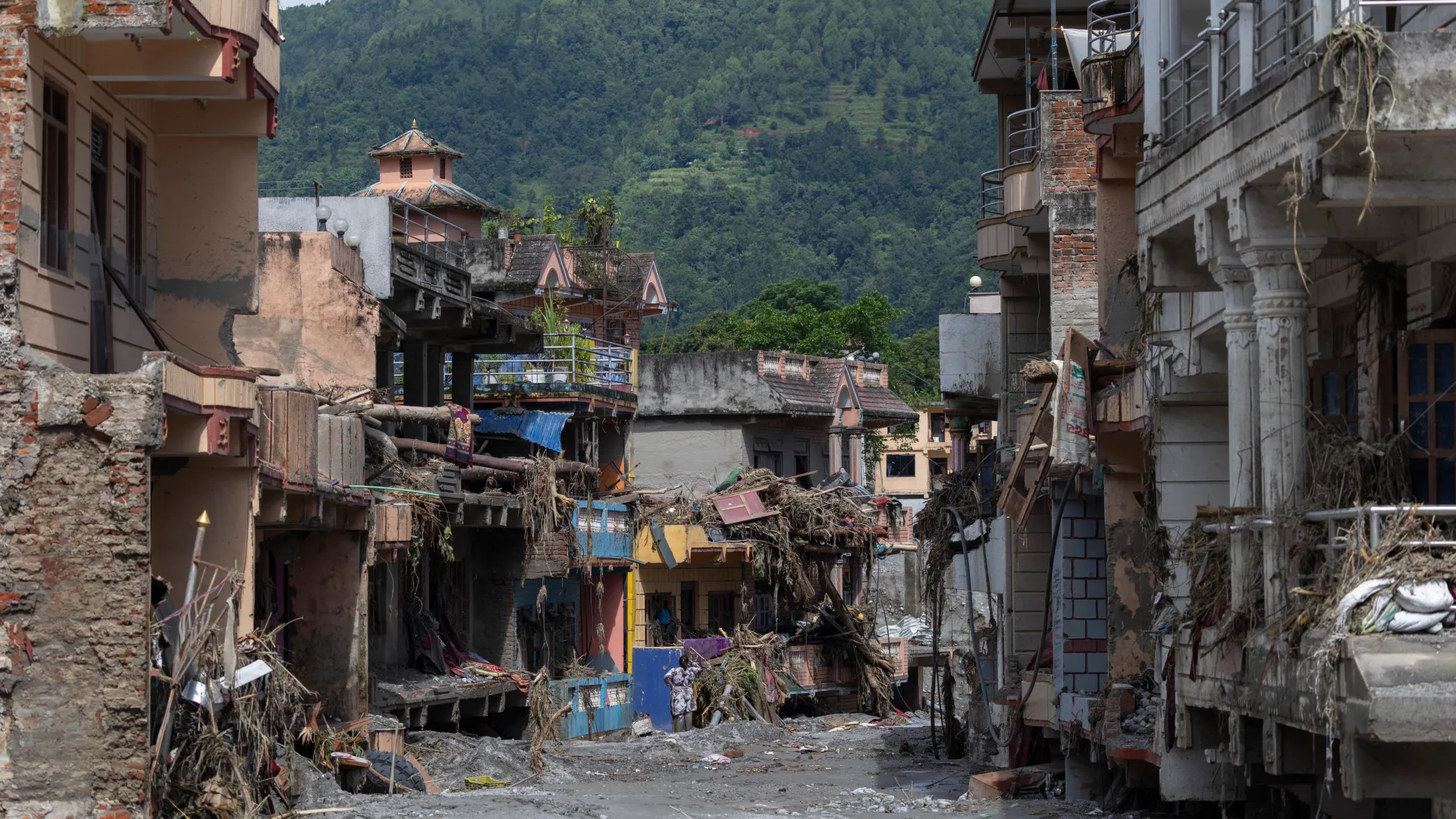
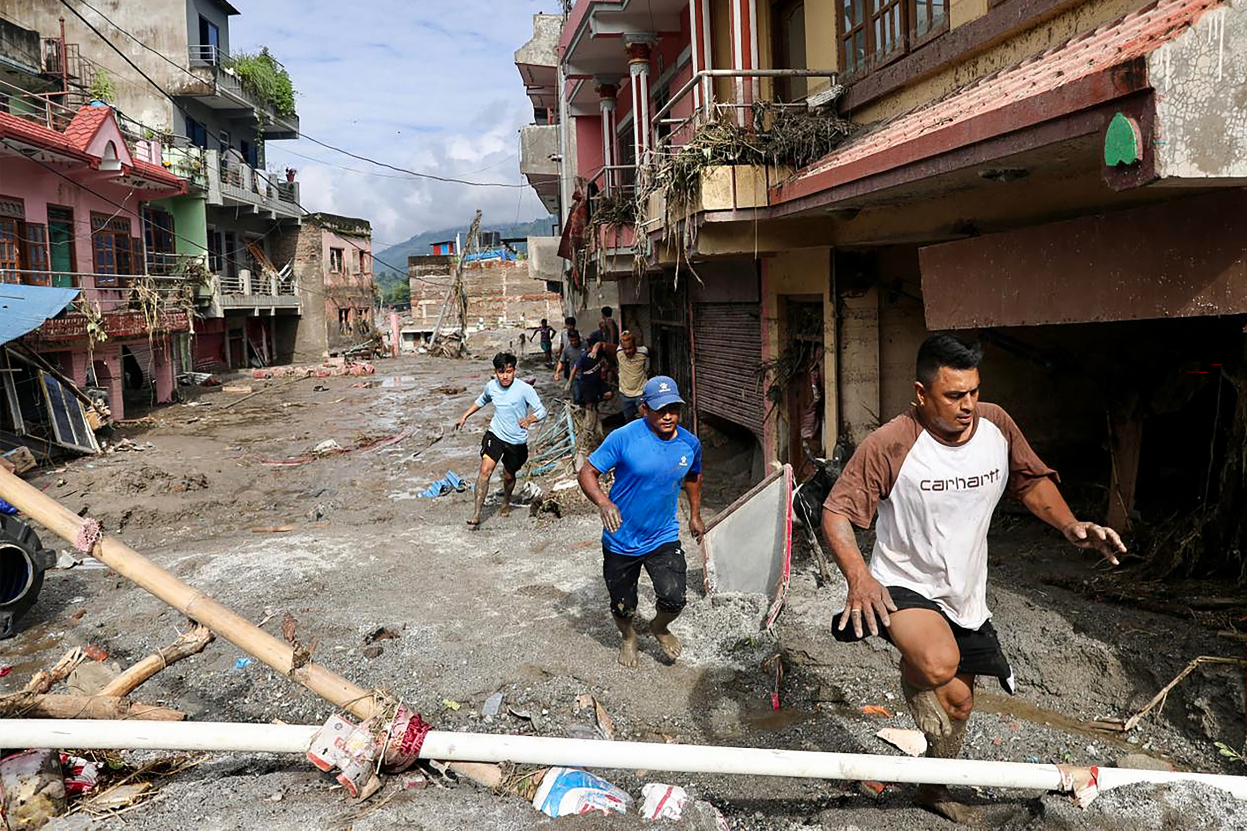
Officials have confirmed that 32 bridges and nearly 25 miles of road were swept away in the disaster, including an entire connecting road through parts of Rasuwa district. Villages including Timure and Syapru Besi in Rasuwa district were among the hardest hit, with flooding reaching further downstream into Nuwakot and Dhading. Thousands of people have needed to be rescued and airlifted from affected areas, including families pulled from flood zones by army helicopter and taken to safety at emergency staging areas like the Maithali Barrack training center in Nuwakot's Trishuli.
Amid the devastation, stories of survival have also emerged, including a 6-year-old girl rescued days after being trapped under debris in northern Nepal, later reunited with her parents in Kathmandu.
International aid has begun arriving to support recovery efforts. The United States has pledged more than $3.6 million in humanitarian assistance to Nepal, up from an initial $500,000 commitment, including up to three months of emergency food assistance for as many as 10,000 flood-affected households.
Is climate change to blame?
Scientists remain divided on the role of climate change in the disaster. Some researchers point to more immediate geological causes rather than a direct climate link, while others argue that warming has likely increased the probability of events like this one occurring by destabilizing high-altitude glaciers and permafrost. Researchers have drawn comparisons to a 1941 glacier-melt disaster in Peru that killed roughly 5,000 people, one of the deadliest glacial lake outburst floods on record.
This is not an isolated event for the region, either. Nepal has now experienced significant, deadly flood disasters along its rivers in 2024, 2025, and 2026 alone, with causes ranging from prolonged monsoon low-pressure systems to glacial lake outburst floods, underscoring the growing vulnerability of Himalayan communities to both extreme rainfall and rapid glacial change as the climate warms.
Authorities continue to urge residents in river-adjacent communities across the affected districts to remain on alert as recovery and search operations continue, with the risk of further flooding from unstable glacial and debris-dammed lakes still an active concern.